|
 Wednesday Wednesday
Low pressure to the northwest of Scotland will move north, while a complex area of low pressure and associated frontal troughs will affect England and Wales. Sunny intervals for Scotland and Ireland but with a band of rain in the west and north moving east slowly. Dry across much of England and Wales with some sunshine but spells of rain will affect Northern England, West Wales and, later, the Southwest of England, while cloudier skies will bring rain to the east and southeast during the evening. South or southwest winds will be fresh around northern and western coasts and a brisk south or southeasterly breeze will develop around coasts in the east later. Highs 8 to 11C in the north and west, 12 to 13C in the south and east.
 Wednesday Night Wednesday Night
Mostly dry across Scotland and Ireland with only isolated showers in the west. Two discrete bands of rain, heavy at times will affect England and Wales, though, one in the north and west, with the other extending north across the east and southeast, areas in between staying largely dry. Lows mainly in the range 5 to 10C but colder with a localized frost or ground frost for some northern and western areas.
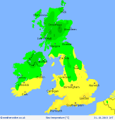
 Thursday Thursday
Frontal troughs over England and Wales will move east, with a ridge of high pressure building into Western areas. Rain over England and Wales will start to clear with skies brightening, although wet weather may linger in easternmost counties of England for much of the day. Sunshine and a good deal of dry weather for Scotland and Ireland but western areas will have some showers. Winds light to moderate in strength, with a west to southwesterly bias. Highs 8 to 11C in the north, 11 to 14C in the south.
 Friday Friday
A ridge of high pressure, extending north across much of the British Isles at first, will transfer east as a deep low tracks northeast from mid-Atlantic, driving frontal troughs into the north and west. Central and eastern areas of England mostly likely staying dry, with some brightness by day. However, after a dry start rain, heavy at times, will move into northern and western areas, accompanied by strengthening south to southwest winds with gales developing in exposed areas. Highs 9 to 13C.
|
