|
 Tuesday Tuesday
A low pressure area is over the Atlantic on Tuesday, centred to the south of Iceland, which extends fronts across the British Isles. It will be a cloudy, wet and windy day for most as a band of rain works eastward. The rain will reach western Scotland, western fringes of Wales and southwest England by the morning, spreading eastward to reach most areas by mid-afternoon. The highest rainfall totals will be in the west. Cloud may break over Ireland by the evening. It will be another windy day, particularly ahead of the heaviest band of rain with gales in places. Highs at 7 to 10C.
 Tuesday Night Tuesday Night
Skies will continue to clear from the west through Tuesday night and into Wednesday but eastern areas will hold on to the cloud through the night. The heaviest band of rain will clear to the north but will linger over the Northern Isles while some drizzly rain will develop for western and southern coasts. Temperatures will drop to 3 to 7C for towns and cities.
 Wednesday Wednesday
An area of low pressure remains to the northwest of Scotland on Wednesday. It will be a bright and dry day for most areas away from western and southern coasts where there will be showers and prolonged spells of drizzle. It will also be a rather damp day for southeastern parts of England too. Winds will ease from Tuesday but will remain fresh in places. High temperatures at 6 to 9C.
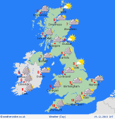
 Thursday Thursday
Low pressure is again in control through Thursday but the centre of the system moves to the north of Scotland and starts to fill. It will be another day of sunny spells and scattered showers. The heaviest showers will fall over northwestern Scotland and the Lake District while Ireland, North Wales and central and northern England will see the best of the brightness. Highs at 6 to 9C.
|
