|
 Friday Friday
Low pressure drifts northeastwards with a ridge of higher pressure building on Friday bringing a dry day for most and sunshine for a time. Windy across northern Scotland with showery rain gradually easing and clearing from northern regions here though always the risk of some scattered showers. Rain and strong winds return to Ireland, Wales and southwest England by evening. Highs at 7 to 11C.
 Friday Night Friday Night
Overnight, outbreaks of rain and strengthened, blustery winds affect many areas of the country, clearing from far western areas and perhaps not quite reaching the far SE of England until morning. Lows at 5 to 10C, cooler across northern Scotland.
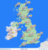 Saturday Saturday
A deep and broad area of low pressure sweeps in wet and windy weather from the west on Saturday. Fronts passing east taking heavy periods of rain with them during the morning. Brighter, blustery conditions following into the afternoon with showers, some heavy on western coasts and hills as well as perhaps wintry. Highs at 6 to 9C.
 Sunday Sunday
Sunday will continue to be blustery. Frequent and heavy showers for many in the west, these merging into longer spells of rain across western Scotland. There is a risk of hail and thunder too within the heaviest showers. Outbreaks of rain could get heavy for a time as they pass across Wales and England. Highs near 6 to 9C.
|
