|
 Friday Friday
Cloud and outbreaks of showery rain affecting England and Wales through Friday, some of the showers heavy. Tending to turn drier and brighter in the west later. Further rain and showers in western Ireland. Snow over the hills of western Scotland. More persistent rain across East Anglia and southeast England. The best of any sunshine in eastern Scotland and northeast England. Gales could affect the far north of Scotland. Highs at 10C in southeast England, 6 to 8C for most.
 Friday Night Friday Night
Showers at first, most in northern England with another areas in the far south of England. A further band of wintry showers affecting northern Scotland. Turning drier from the west with clearer skies developing during the night. The winds becoming lighter too with lows at -3C in central Scotland, 0 to 2C for many other areas. Roads and pavements may become icy by the morning.
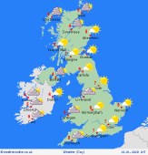 Saturday Saturday
Higher pressure builds over the UK and Ireland on Saturday. There may be some morning fog patches at first, but these clearing quickly. Scattered showers in northern and western Scotland. Dry elsewhere with long spells of sunshine. Feeling cool too with temperatures at 5 to 7C.
 Sunday Sunday
High pressure dominates on Sunday. Fog and frost may be widespread over all but central and northern Scotland, although this should lift to leave dry weather and good spells of sunshine. Increased winds over northwest Scotland with cloud and outbreaks of drizzle here. Temperatures reaching 5 to 7C.
|
