|
 Saturday Saturday
High pressure to the west influences much of the British Isles, whilst a weak cold front passes southwards. Dry overall, just a chance of local spots of rain from thicker cloud in the south. Brighter skies in the north, with good amounts of sunshine, best around western coasts in the afternoon. A few showers in northern Scotland. Light north-westerly winds. Highs 10 to 12C north & east, 14C central areas, 15 or 16C south-west.
 Saturday night Saturday night
Most places will be dry overnight. Isolated showers in northern Scotland. Variable amounts of cloud across the country, but some breaks will occur, allowing temperatures to fall low enough for a touch of frost in rural areas by dawn. Light winds. Lowest temperatures likely in west & northern regions, 0 to 3C, perhaps locally just below freezing. Nearer 3 to 5C in central, east & southern areas.
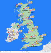 Sunday Sunday
High pressure across the south, whilst pressure falls from the north, as fronts move into Scotland. Generally dry for most, with good spells of sunshine in the south, but cloud thickening in the north & west. Showery rain or later hill snow for northern Scotland. A few showers may reach north-west England by evening. Light winds, but will freshen in the north. Highs 12 to 16C, warmest in central & southern areas.
 Monday Monday
A cold front passes south across the country, introducing significantly colder air across the British Isles. Occasional showery rain for southern regions, although much of England & Wales will be often dry with sunny spells. Showers will spread from the north across Scotland, later Northern Ireland - heavy bursts, with hail and thunder, and snow to low levels. Cold and blustery northerly winds. Highs 6 to 9C north, 10 to 13C south.
|
